
MIAMI VALLEY — The Miami Valley can expect to see strong to severe storms Wednesday evening.
[DOWNLOAD: Free WHIO-TV News app for alerts as news breaks]
TRENDING STORIES:
- County-wide call for assistance after ‘weapons call’ in Trotwood
- Coroner IDs 7-year-old missing girl who drowned in retention pond
- 1 dead after fire, SWAT situation at Ohio home, police say
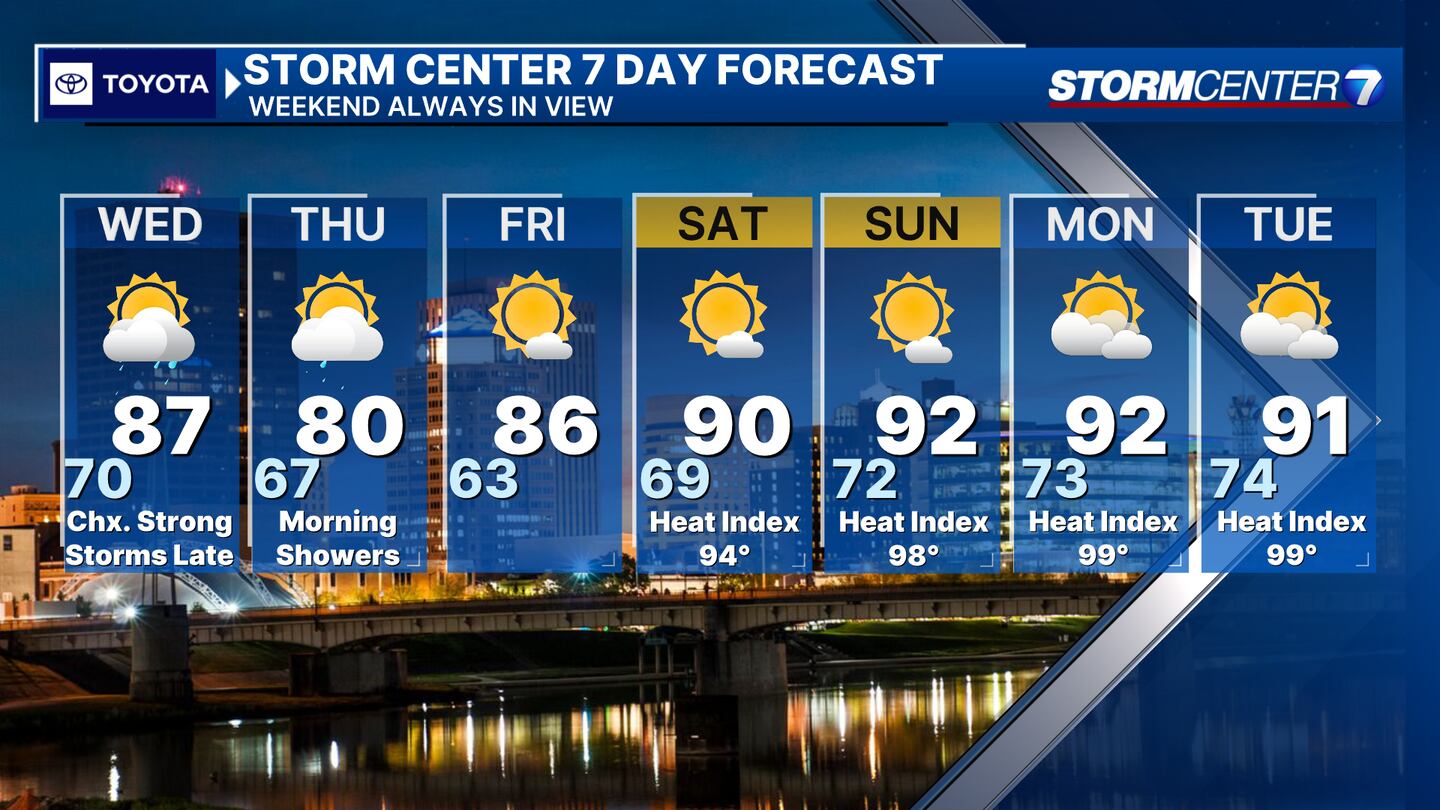
Tonight, it will be mostly cloudy with a chance for showers early. Showers eventually taper off. Warm and muggy overnight. Lows near 70.
Chaney said he is tracking a possible MCS for Wednesday. What is an MCS? Mesoscale convective system... a line of strong storms that brings mainly a damaging wind threat, but can occasionally include hail or brief tornadoes.
Recognizing the pattern that causes MCSs is fairly easy. Saying specifically what time and where they’ll hit is more difficult. Wednesday morning - early afternoon: Partly cloudy. Isolated shower or storm possible, but unlikely to be severe.
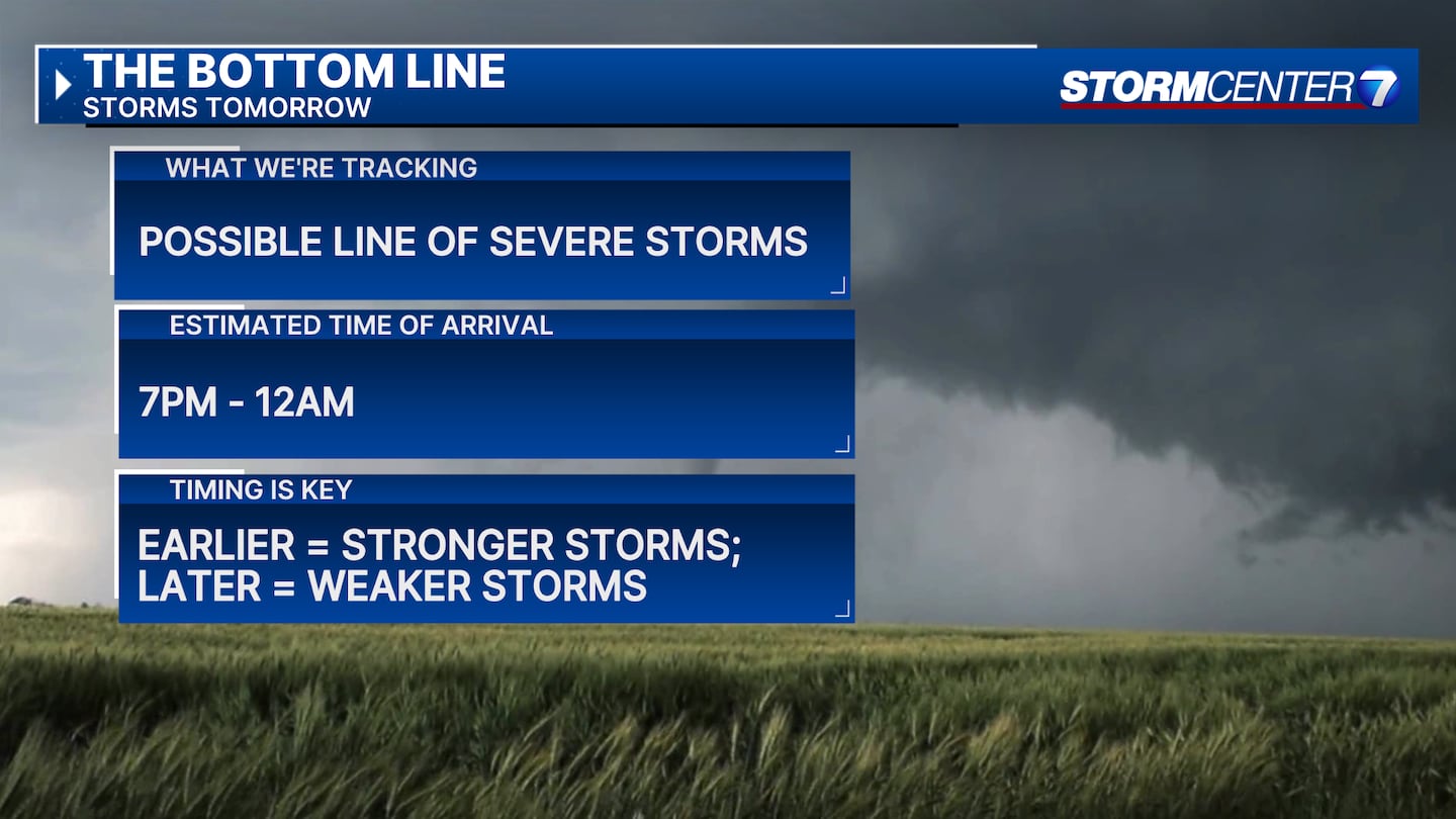
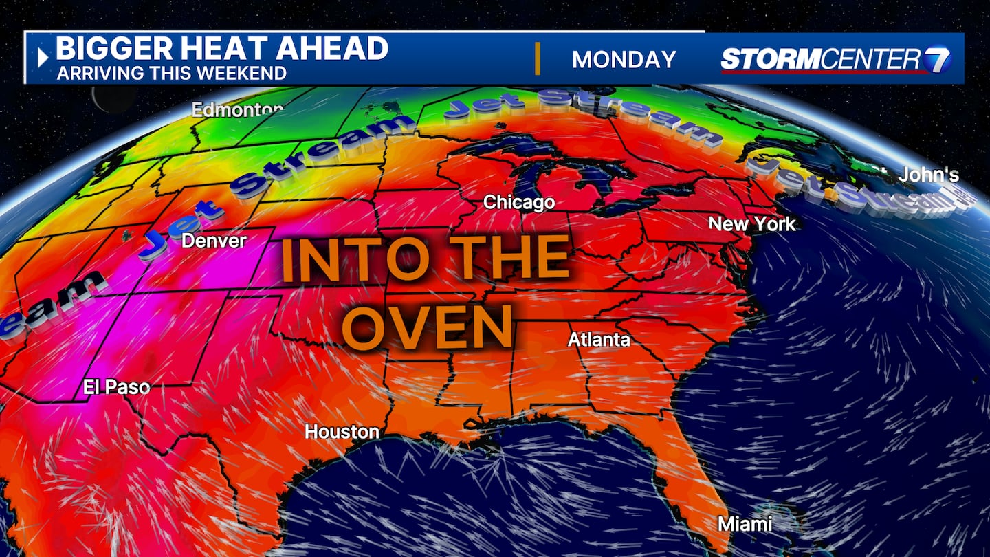
Hot and humid. Highs upper 80s. Feeling like 90+. Breezy. 7:00PM Wednesday - 12:00AM Thursday: Greatest opportunity for severe storms. If we are going to get hit by an MCS, this is the most likely timeframe.
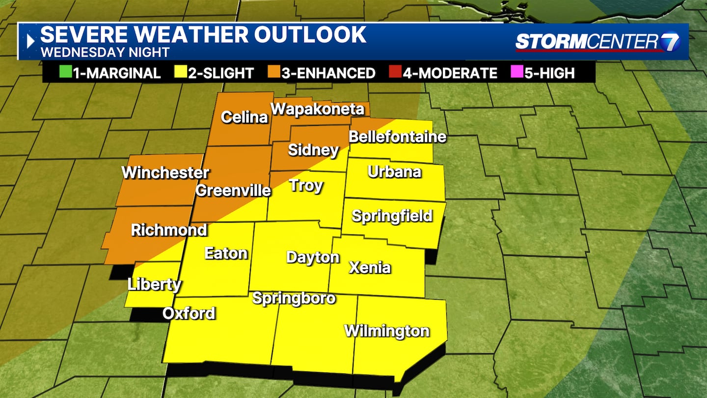
Storm threats include mainly damaging winds, but also a lower, but not zero risk, of large hail and/or isolated tornadoes. SPC indicates a level 3/5 risk for part of the DMA, 2/5 risk elsewhere.
[SIGN UP: WHIO-TV Daily Headlines Newsletter]
©2025 Cox Media Group
 Sign Up

